I probably look like a tourist.
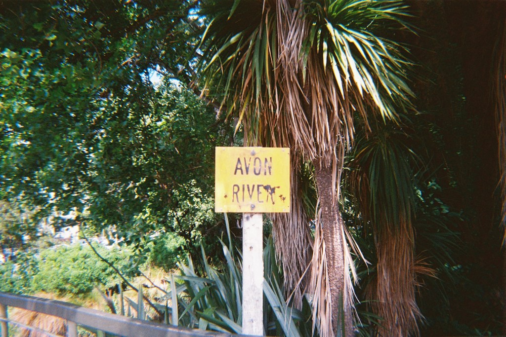
Walking along the Ōtākaro Avon River, head tilted back to take in the sights, snapping photos of the trees and wildlife on my retro 35mm camera (talk about cliche), I can’t help but wonder how I must appear to passersby. The sun beats down and the trees that frame this wide, freshly paved path don’t quite extend their shade into the middle of what used to be River Road. The sweaty fabric of my top sticks to my back and I am sure the thin line of exposed skin in the parting of my hair will soon burn.
I am a tourist of sorts – one who has lived in the western suburbs of Christchurch my whole life. I was ten years old when the first earthquake struck Canterbury, and if I spent any time in the residential areas of the east, I don’t remember it. The Christchurch I grew up in was strange, unfinished – a half-broken puzzle, barely held together by a skeleton of remaining pieces. As a moody, traumatised teenager I liked to think of it as a wasteland. But in truth, I never visited the areas of the city that actually fit that description.
Like any good tourist, I have done my research to prepare for this trip; over the past few months, I have been reading interviews from the University of Canterbury QuakeBox Project that took place in 2012. Residents from Lyttelton, Sumner, Brooklands, and New Brighton told their stories of the earthquakes in a mobile shipping container that traveled around the city. They talk about their homes and communities, the weeks shovelling liquefaction, the portaloos and water supplies and the battles to save houses that would be demolished in the years to come. Reading these interviews well over a decade later is like looking into a world on the brink, scared and hopeful and unknowing.
I am not doing this research recreationally; my work is part of a project run by the University of Canterbury to document the locations mentioned and talked about in the QuakeBox interviews. I read through each story and tag each location, finding the precise spot on Google Maps. Precision is the tricky part, as many of these places – restaurants and offices and shops – have moved or stopped existing altogether. So Google Street View is my friend, with archived street footage going back to December 2007: in the city centre, the Town Hall displays a poster for Split Enz; those classic Christchurch tinsel decorations adorn each lamppost. This is how I learn the streets of my city – by stepping back in time.
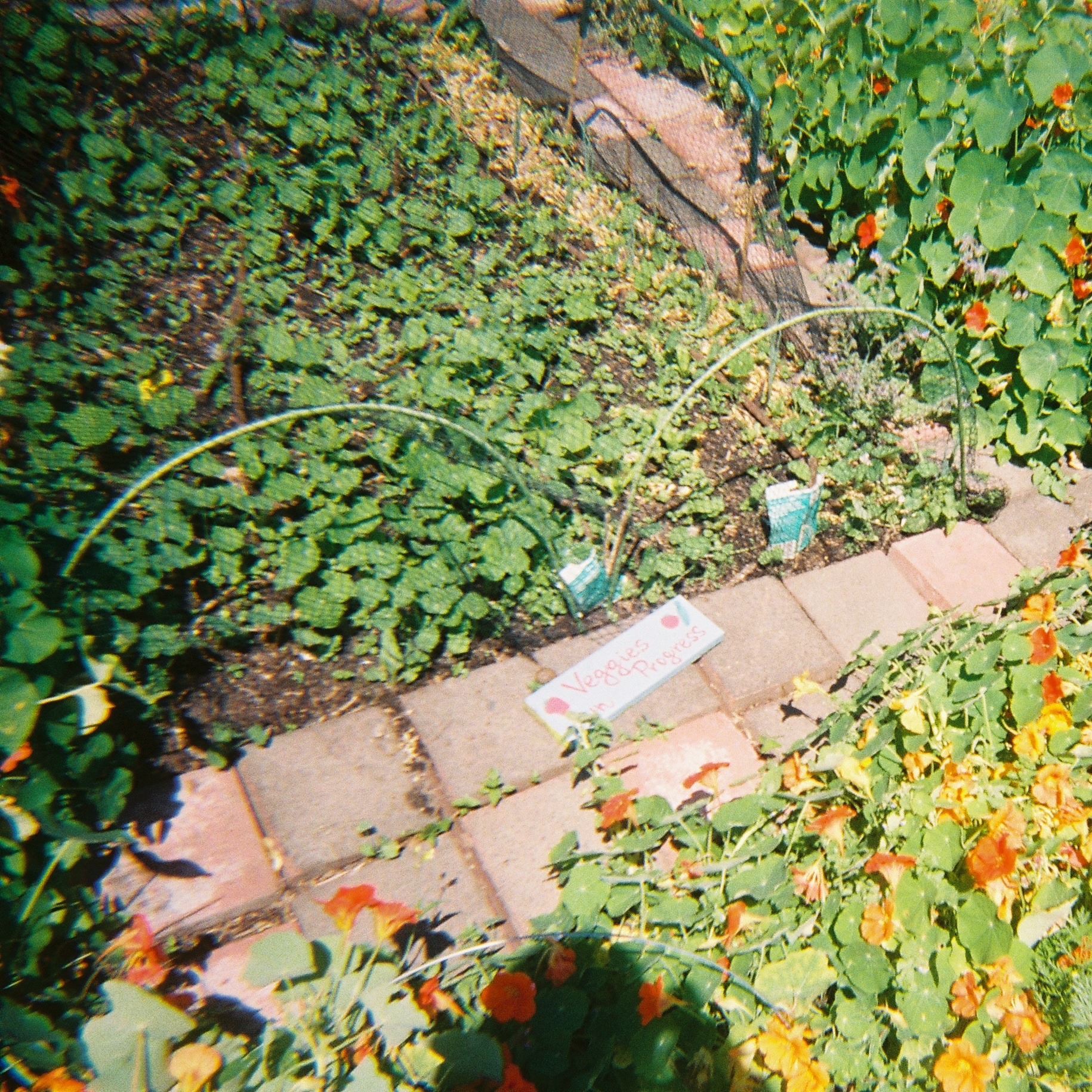
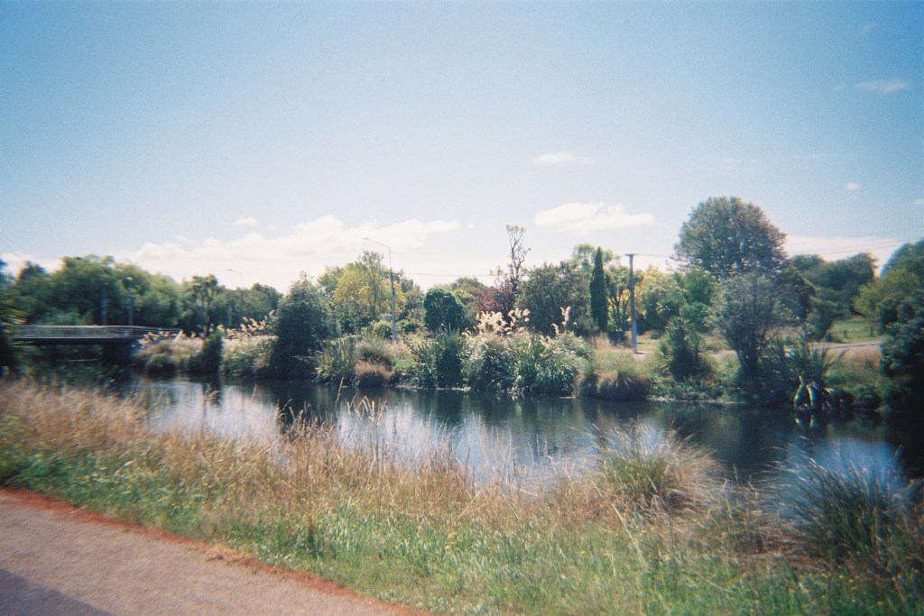
As I follow the Ōtākaro Avon River out of the city, the traffic starts to thin and then drops away entirely. Suddenly, all is peaceful and green, the empty lots along the path more like a strangely shaped reserve than the remnants of a neighbourhood. Geese potter along the river, ducking underwater to display their feathered tails and webbed feet. The typical markers of urban civilisation are nowhere to be found, and then I come to Riverlution Cafe next to the Richmond Community Garden. It’s a small, shed-like building – off the path but well signposted – with sweeping shade clothes, mismatched tables and handwritten signs advertising real-fruit ice cream. The garden expands on this completely new and cheerful world with oddly dressed scarecrows, rustic flowerbeds and brightly painted plant labels that proclaim “Veggies in Progress”. A ring of upside-down letterboxes act as both a small memorial to the lost houses, and as unorthodox pots for flowers. This is where I eat my lunch, sitting on an old wooden chair and listening to the distant cars passing and the much closer call of a rooster.
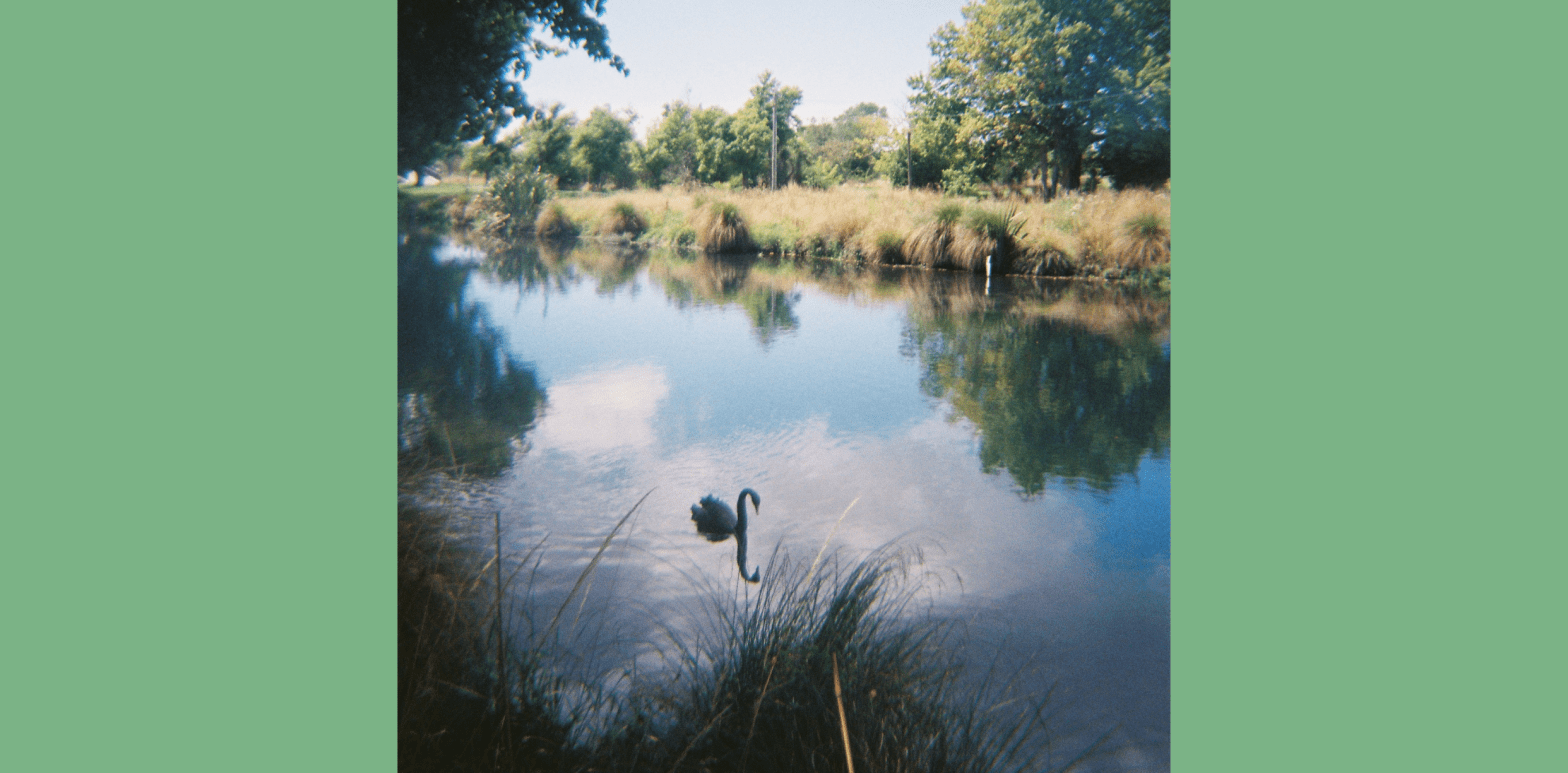
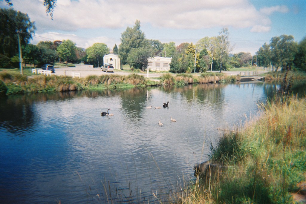
Further along, the bustling air of the cafe gives way to quiet wilderness once more. A pair of black swans and their five cygnets meander along the river beside me. Occasionally, evidence of residential properties surface – the remains of a treehouse hangs crookedly across a branch – but it’s difficult to imagine the suburbia that once was. Perhaps the most obvious clue is the footpath itself, the width of which is more suited to cars than those on foot; it feels strange to walk down the middle of such a wide, paved road. Perhaps that is why a desire path has been etched out in the grass of the riverbank.
I cross the river into the loop of Avonside Drive and for the first time, the marks of old properties and streets are truly visible. The smooth new pavement crosses right over a crumbling, potholed road; old street signs linger and lopsided powerlines rise from the ground, their drooping electrical cables connected to nothing. Google Maps displays Sullivan Park at the top of this loop, but it’s hard to see where the park ends amidst all this green.
But something else was left behind after the demolition of so many homes: trees – fig trees, peach trees, kōwhai and plum and apple and apricot – marked on the map for all to visit. Once part of many private gardens, these remnants of the past are now available for public enjoyment, even garnering reviews on Google. A five-star review of a fig tree calls it “the figgiest and biggiest,” another of a peach tree says, “not quite in season but a lovely walk. Look forward to coming back another day.” I’m not sure why these little comments make me so happy – maybe it’s just knowing that these spaces are still a source of happiness and growth after so much loss.
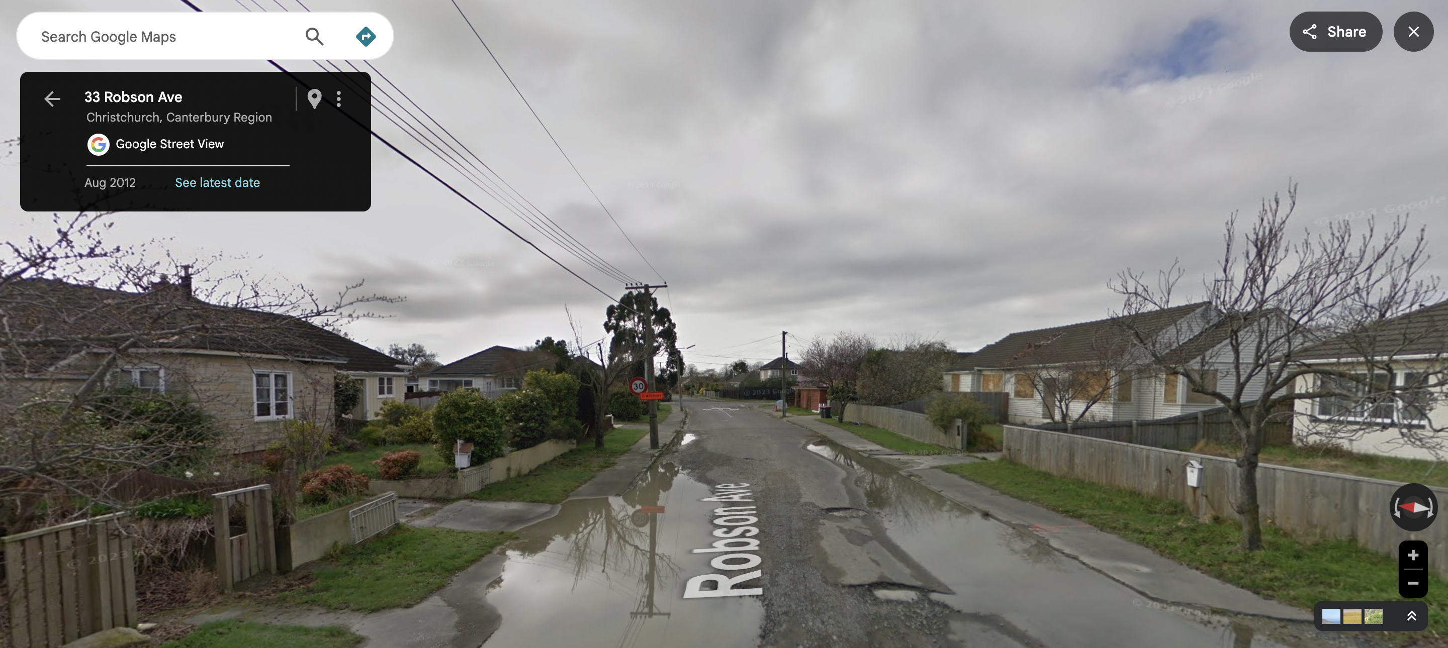
If you click into Street View on the Avonside loop, Google will probably take you straight back to August 2012 – for some areas of the Red Zone, this seems to be the only footage stored by Google. Travelling through these parts of Street View feels jarring and almost voyeuristic: water clogs the gutters, houses sit empty with boarded windows, and the dirty grey remains of liquefaction splatter the cracked roads. Where Street View usually captures the blurry or distorted figures of people going about their day, the loop appears to be utterly deserted – the only sign of human life is the shadow of Google’s 360 camera car.
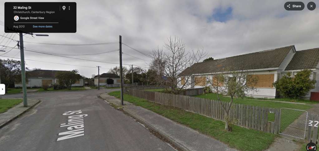
I first noticed this anomaly at the end of 2025, while working at the university. I had travelled to many times and places in Christchurch through Google Street View, and it could be inconsistent in some areas of the inner city. But to discover that so many eastern suburbs had been virtually undocumented for thirteen years was more than bizarre – it felt cruel somehow. Why did Google feel the need to freeze these ghost-neighbourhoods in time? It wasn’t an issue of drivability – technology has advanced so much that Street View captured the top of Machu Picchu in 2015. Did they think it was important to memorialise the lost suburbs of Christchurch for historical posterity? Or did they simply stop caring once these areas were no longer populated? Somehow, I can’t picture one of the biggest tech companies on the planet giving much thought to a broken city at the bottom of the world. It’s much more likely that they forgot about us, leaving behind a digital monument to these communities in crisis – a final snapshot of the eastern suburbs, preserved for as long as the impermanent internet allows.
At the Snell Place Footbridge, the restoration project rears its conspicuous head: the new pavement ends at a wire fence, a digger at work on the path beyond. After fifteen years, this is the extent of the repair. Locksley Ave stretches before me, unapologetically crumbling and wild, cicadas drilling their song into this vast and open space. So I venture into the Residential Red Zone.
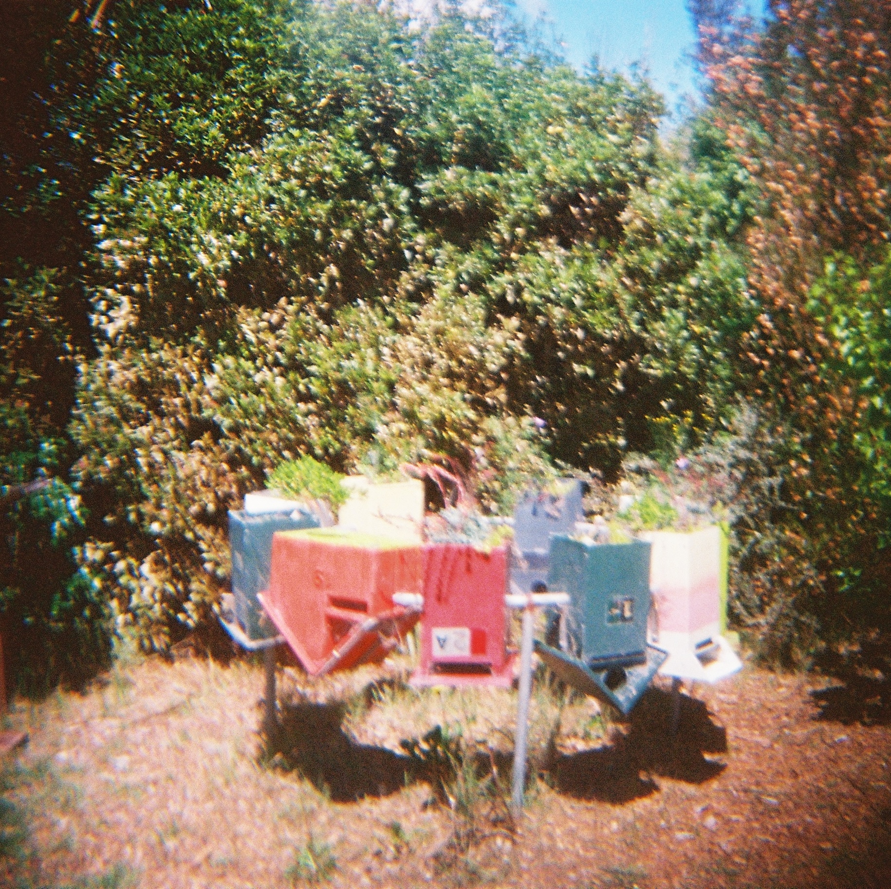
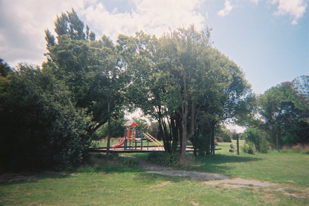
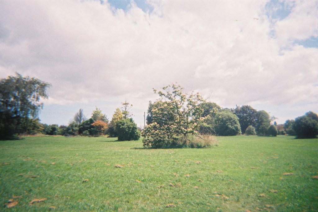
I have often heard this area described as dead, empty, a ghost-town, but my first thought is that it seems deeply alive. True, there are no humans here and the few remnants of the neighbourhood have an eerie feel about them, like the lone playground with its faded plastic and lichen-riddled slide. But I can’t help feeling excited by this unlikely wilderness buzzing with natural life. What will this place look like in another fifteen years, with three decades of growth to display? I find a cluster of beehive houses under a tree, the insects flying in and out of each box. One particularly curious bee follows me for several minutes, perhaps interested in the flower designs embroidered on my top.
I get the sense that I am somehow intruding on this strange, overgrown world in the middle of the city. On one side of me lies the river, geese calling out across the water; on the other side, green stretches out, overwhelming the asphalt streets. A lady on a purple bike whizzes past with a cheery greeting, only to reappear five minutes later saying, “I’m not where I should be!” It’s true that each path looks the same, and without my phone, I might find myself easily lost in the maze. This space belongs to nature now, and we humans are simply visitors. Some may find it sad, but I think it is refreshing to witness this reversal, this reclaiming of an urban space.
Parts of the Red Zone have been captured more recently on Street View, though not by Google. A user called “blackmaps geospatial” biked through the streets in December 2023, documenting the transitional phase of this area. Despite the sagging powerlines and weeds shooting through cracks in the pavement, this footage is undeniably brighter than the dour images from 2012. I’m sure the weather plays a large part in this; the clear summer sky rises above verdant plantlife, the greens and blues much more pleasant than the muddied grey of winter in 2012. But the historical footage also shows a community barely held together – broken houses riddled with liquefaction and streets filled with potholes. The newer footage is entirely different: a changing environment, adapting to arrive at something new. I believe the Red Zone is becoming something exciting, and it is the people and communities of Ōtautahi that are making this happen.
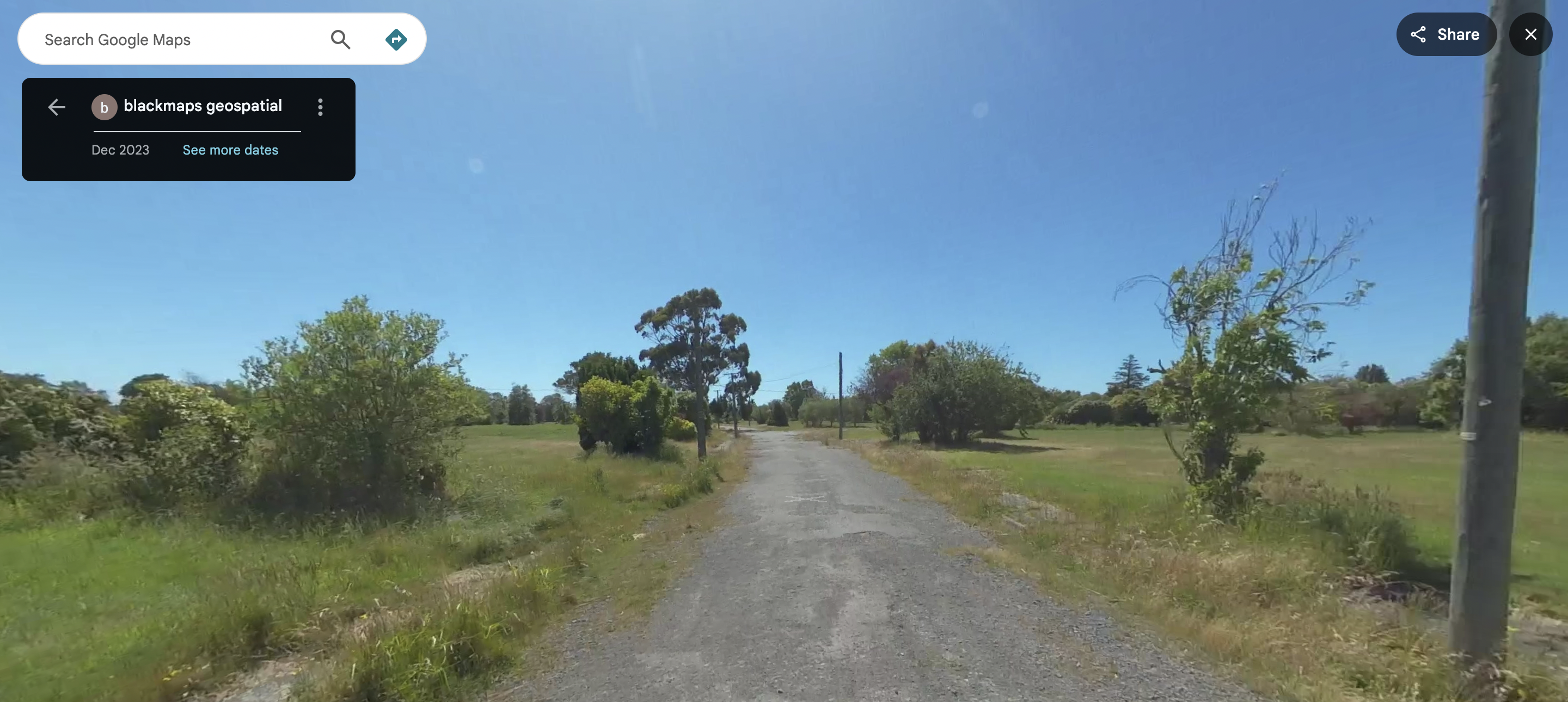
Curious, I searched up blackmaps geospatial, and found a two-person company named after some of the earliest survey plans of Canterbury. Their LinkedIn profile says they were founded in 2023, so their efforts to document the Red Zone in the same year must have been one of their first projects. If you aim the 360 image towards the ground, you can see a person with a flannel shirt and a black helmet on their bike, cycling through the empty streets. They even hop into a kayak to capture parts of the Ōtākaro Avon River. It definitely feels more personal and genuine than the hollow, damaged houses snapped by Google in 2012.
The parts of the Red Zone that feel the most authentic and exciting are those that have been made into community spaces, acknowledging the past and working to regenerate the present. The Richmond Community Garden is one such space, with regular volunteer sessions and events like parkruns and yoga, a weekly Farmer’s Market, and the annual Richmond Gala. The Avon Ōtākaro Network (AvON) have been working since 2011 to bring people back into the Red Zone, advocating for this new “Green Spine” that is developing in Ōtautahi.
In many of the QuakeBox interviews, people mourn the loss of Christchurch – they wonder how many years it will take for the city to recover, if we will ever return to how things were before. Will the Christchurch of old exist again? Most people say it won’t, and they say this with a sense of grief. Reading their words fifteen years on, I agree – we will never go back to a pre-earthquake Christchurch, and in many ways, it is a sad thought. When I look at photos on the Facebook group “Remembering Christchurch” or use Street View to walk through the city centre of 2007, I feel this gripping nostalgia for a place and time I barely remember. How I miss the old QEII pool – but that’s a different story.
Looking through the photos I took on my walk through the Red Zone, I have a strangely similar but opposite feeling. The film camera gives each image a blurred, out-of-time type quality; these empty green landscapes could have plausibly existed in 2020, or 2010, or 2000. But where the old images of Christchurch had only faint memories attached, here it is the photo that is fuzzy and my memory that is clear. The Green Spine exists now, and it is changing and growing, and I am looking forward to visiting it again.
Leaving the Red Zone is a sudden, jarring experience, even though I approach the edge slowly. I walk past a wooden roadblock and immediately, I am surrounded by houses. A car backs out of a driveway; the sounds of the city come flowing back in. It’s definitely cliche, but I can only liken it to Narnia – leaving a strange, magical world that feels like your own personal secret. I do think some people want to pretend that these parts of Christchurch don’t exist, and many have good reason to. There is pain and loss and anger tied up in the history – years of financial hardship and futile battles with the government. But if we let the trauma of the past fester, we will only see what was lost, and not what is already growing – because there are beautiful things growing here.
The Red Zone can also be the Green Spine; it can be a place of remembrance and a journey to an exciting future. It can be a new garden for the Garden City – not one that is pristine or planned like the Botanic Gardens, but one that is wild and sprawling and one that is for all of us.
